As someone who has built a weather app I know a thing or two about weather apps. When I look through posts on social media I see comments about weather apps which are ill informed or not quite right so I created this page to clear up a few things. I’m not writing this to put down other apps, I do however want to highlight some things Aussie fishos should be aware of so they are better informed. Everything on this page is objective and I’ve referenced where possible so you can verify it yourself. -- Joe Greco
Aussie Fishos and Weather Apps
The BOM
Many people talk about getting weather forecasts from ‘The BOM’ but the bureau’s website has a range of tools and people don’t necessarily differentiate between them. I’m going to list the tools and explain a little about each. Users often say that BOM is the source and all apps get their data from BOM so you may as well go to BOM get it. That’s not correct, read on to find out which apps use BOM forecast data and which don’t.
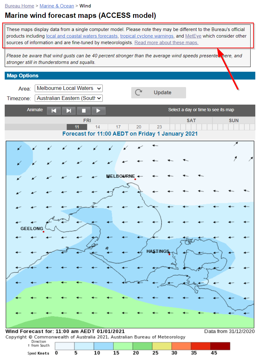
BOM Marine Wind Forecast Maps
If you use this you should stop, this is not BOM’s best forecast data. This is BOM’s second rate forecast data. BOM’s best forecast data (aka their official forecast) is shown on MetEye. BOM have a responsibility to show forecasts for the greater Australasian region for shipping purposes and that’s the only reason this tool still exists on their site, because it gives forecast information from Antarctica to Indonesia. Unless you are going >100km from shore then don’t use this tool. The data MetEye shows only goes out a distance of 100km (60nm) from the Australian coastline and that’s what you should be using if you want BOM’s official and best forecast data. Yes I know you can select a local region like Melbourne or Sydney but that’s because this tool existed before they released MetEye and prior to that this was the primary tool to use. The forecasts here and on MetEye will often be similar, that’s because this model is one of the inputs to MetEye’s data, but MetEye has other inputs and processes that improve the forecast.
BOM state this at the top of the page and on the more information page, see screen shots below.
If you click on the ‘Read More About These Maps’ near the top of the page then you will see it says this:
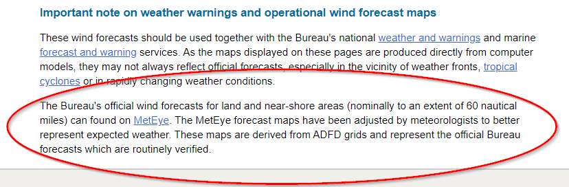
The key point here is to note is that MetEye ‘better represents expected weather’.
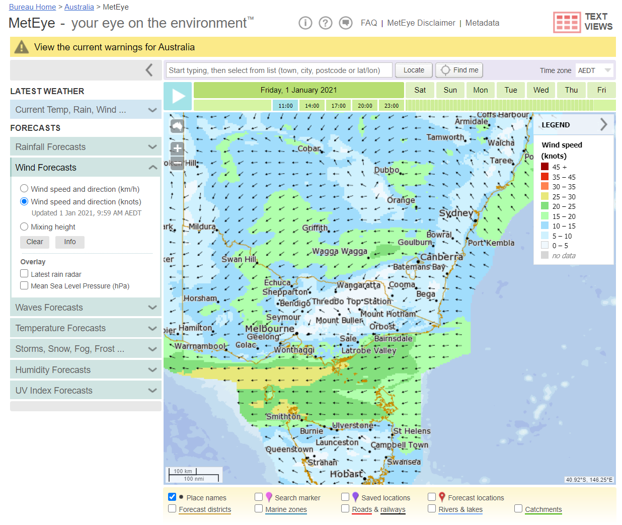
BOM MetEye
MetEye is a viewing tool for BOM’s official and best forecast data, that forecast data is called the ‘ADFD’ data grids. MetEye shows data in a wind map style which shows a wide area at a single point in time. This is good to see how wind is moving across a region but makes it hard to see what wind will be like in future as you need to play it forward to that time step. You can’t just glance at MetEye and see what wind is doing over the next week.
MetEye only shows every 3rd hour of the data despite the underlying data having hourly time steps. This makes MetEye a poor choice to know when fronts are expected to hit as it could be within a three hour window that it can’t narrow down on. Note: Users often say that BOM forecast every third hour then apps use algorithms to work out the intervening hours but that is incorrect. The forecast grids are hourly, MetEye only shows every 3rd hour.
You can click a spot and it will return the forecast in a table for that spot but again it only shows every third hour.
You will note that the forecast only goes 100km out from the shore – which is related to the point I made earlier about the Marine Wind Maps.
Meteye does not show any live information like Wind Speed or Temperature. It also doesn’t show tide information or other variables like Air Pressure (aka barometer) and sun & moon times which fishermen need. It’s also hard to use on a mobile phone. While the data Meteye shows is the best BOM produce, the viewing tool itself is poor and you can get the exact same information elsewhere (keep reading to find out where)
BOM Marine Text Forecasts
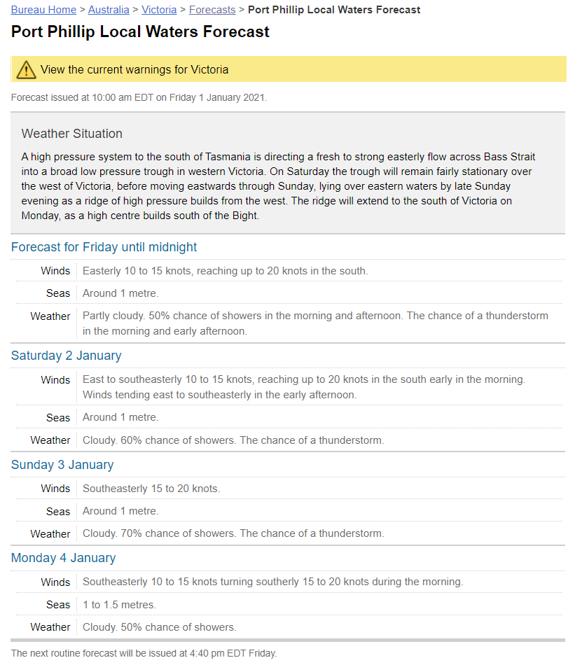
This section of the bureau’s site gives a text based forecast of expected marine conditions up to 4 days ahead. These text forecasts are created by meteorologists who summarize data from MetEye into words. This is good to get a general idea what is going to happen in an area. Viewing a chart (or MetEye) of expected wind, wave or swell for the exact spot you are going is required in order to get an accurate feel of what conditions are expected to be like as they can vary across the region and the generalized summary won’t capture that. The marine text forecast is however handy for a quick summary.
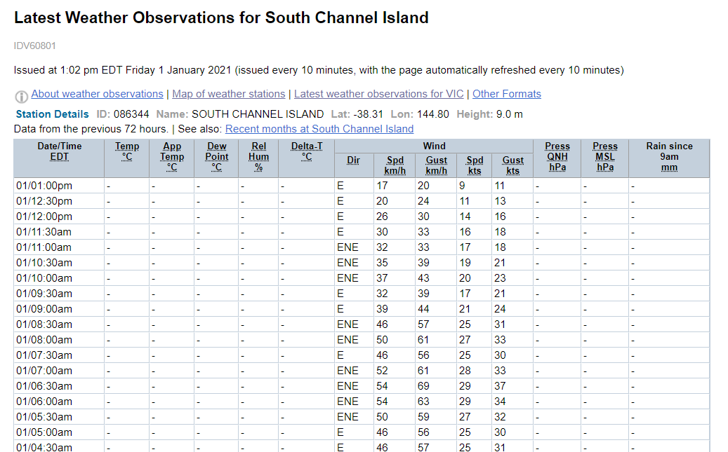
BOM Live Observations
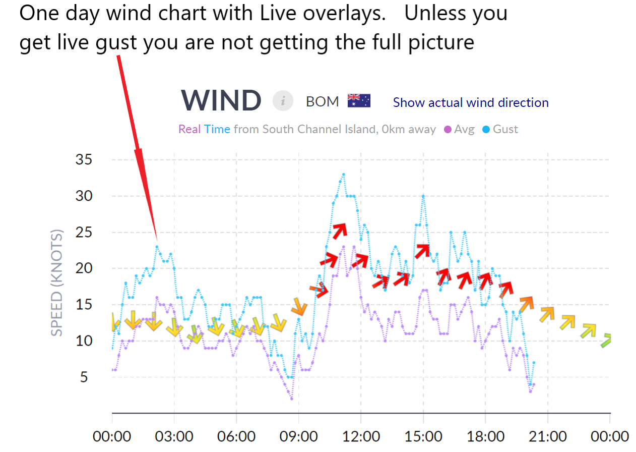
When users of ‘The BOM’ want live data so they can see what the wind is actually doing they come to this page where they select an observation station and see its readings. This page only shows point in time readings every 30 mins, two readings an hour is hardly going to give you a good feel what the wind is doing. The data is actually recorded every 10 mins but they don’t show it on this page, BOM don’t show it anywhere on their site, but they do make it available to organizations. Fish Ranger get this data and show live readings (average AND gust speed) from these same weather stations every 10 mins and its plotted on the forecast chart so you can see graphically how its going. Seabreeze also provide live readings as do Willyweather however Willyweather only show average speed not gust speed – its gusts that cause the chop so you need both to get a good feel what the wind is doing.
Other Apps..
Willyweather
Willyweather is another viewing tool for BOM’s official forecast data. Ie it shows the EXACT same values as MetEye just in chart form instead of a wind map, this is true for Wind, Temperature and Rain. The data isn’t ‘improved with algorithms’, all that is nonsense, data is just read out of a file supplied by BOM and displayed on screen. If you compare them at the same location they will be identical. Yes I know this may come as a shock to many, all the hours you’ve spent comparing MetEye and Willyweather to get a consensus have been a waste of time. Willyweather does however show every hour rather than every third hour like MetEye so it is better to see when fronts will hit. It also gives live average wind speed from the closest observation station.
Willyweather however is not a marine weather app – most of its locations are land based and not on the open water. This is the biggest mistake Australian Fishermen make – they look up weather forecasts in the suburb where they launch their boat instead of on the actual water. A forecast for the open water is a Marine Weather forecast. Wind offshore can be twice as strong as on land so you need to check the forecast out on the water where you intend to go. Maritime Safety warn boaters about this, see what they about it by clicking here.
Willyweather also don’t give you the marine text forecast, ie the “WINDS: Easterly 10 to 15 knots, reaching up to 20 knots in the south. SEAS: Around 1 metre.’
Windy
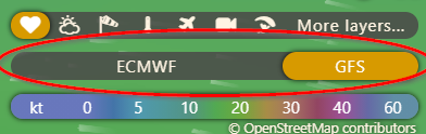
Windy is an app from the Czech Republic that shows forecast data in the form of an animated wind map. It allows you to select one of two forecast models – the European model (ECMWF) or the American model (GFS). It is important to note Windy does not use any BOM Forecast Data. While the European and American models are good global forecast models, they don’t take into consideration any local meteorological information, are not verified by BOM meteorologists, and do not get updated in the face of rapidly changing weather systems like BOM data does. We have an agency funded by the taxpayer to produce the best forecast data for Australia, if you use Windy you are ignoring that data. I agree its good to get a second opinion, and in some areas you may find an overseas model performs better than BOM, but when none of your opinions use BOM data then there is a gap. For live wind readings Windy only provides one an hour so it’s not effective for checking live conditions.
Windfinder
Windfinder is a German app that shows wind data as an animated wind map. Similar to Windy, Windfinder does not use any BOM forecast data, it presents only the American GFS forecast model. If you want detailed forecast data, presented in a table, you must click on one of their registered dots as shown on the image below.
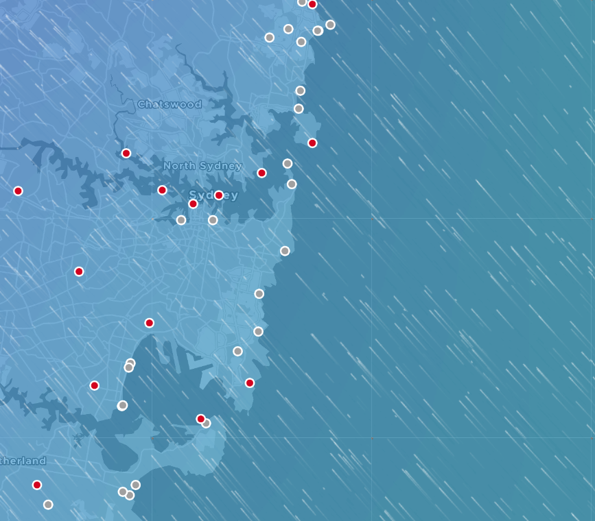
None of these dots are over open water so you are not getting a marine forecast, you are only getting a land based forecast when you do this and as I’ve already said you need to be using a marine forecast when heading out in a boat. Sure it will be the same or similar a lot of the time, and that will make people think it’s accurate, but in some circumstances, which can be frequent, land based forecasts will be very different to marine forecasts. Read our article to find out why.
Seabreeze
Seabreeze is an app that gives a weather forecast for somewhere but no one knows exactly where. Forecasts are always tuned to an exact spot, seabreeze don’t tell you where their forecast is tuned to, it just says a region like ‘North Coast’ or ‘Metro’. Presumably given it is a site built for windsurfers it is a forecast tuned to a popular windsurfing spot on the coastline. Wind can be different at the coastline v’s a point near shore or out wide, especially when wind is blowing parallel to the shore, so its not a great idea to use Seabreeze when heading out in a boat. Seabreeze also don’t state what forecast data they use – BOM, American or European so that’s another mystery.
You need to check the weather over the patch of water you are intending to go, not at some other location, especially when you don’t know where that location is.
Seabreeze also don’t give you other information you need like temperature, rain, tides for all areas, air pressure forecast, bite times etc. They do give you live wind readings with average and gust which is handy but they also don’t overlay it on the forecast which is a nuisance as you can’t tell see how its tracking to expected.
Fish Ranger
This is the site that I built. I am a fisho from Melbourne who got tired of checking several weather apps and not knowing which to trust so I decided to do something about it and that’s how Fish Ranger was born.
If you subscribe to premium you get access to even more features which take it to the next level. Try it free and see for yourself.
You can get a detailed understanding how Fish Ranger is different by clicking here.
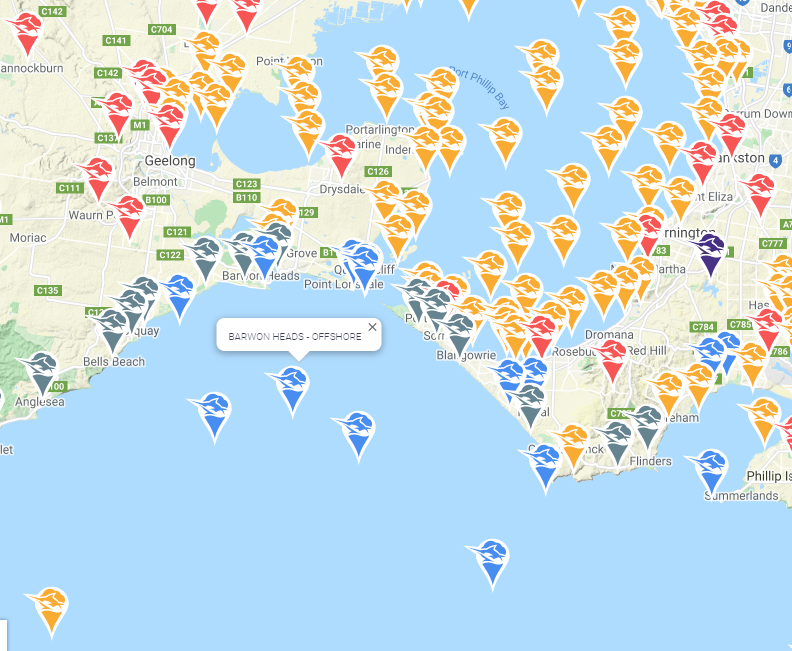
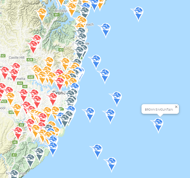
Fish Ranger provides both land and marine forecasts. You can select locations on land, coast, nearshore or out wide and get forecasts tuned to those exact spots. You can request new locations exactly where you fish if there isn’t one already there.
If you are going to chase tuna or swords then actually check weather at The Horseshoe or Brown’s Mountain, not in the nearest town 60km away back on land. -- Joe Greco
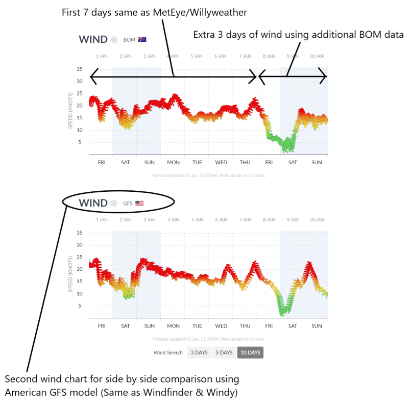
One of Fish Ranger’s greatest strengths is that it shows two wind models side by side – BOM’s best model and the American GFS model. You can see a side by side comparison of Australia’s best data and the American data to get a consensus without having to switch between views or apps.
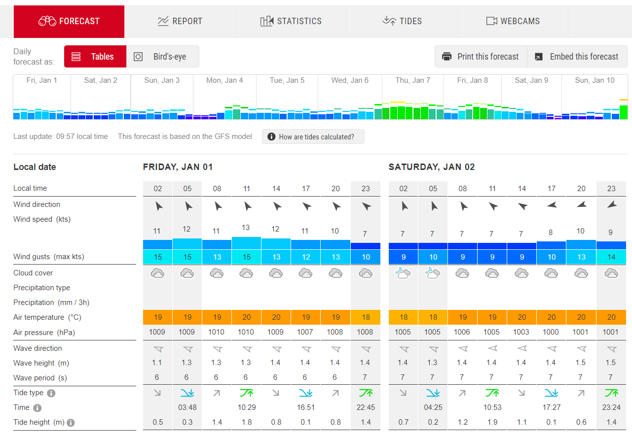
The first 7 days of our BOM wind chart are identical to MetEye and Willyweather, there is no difference in values when comparing at the same location. We also use additional BOM wind data modeling to provide an extra 3 days of forecast giving 10 days forward.
Our second wind chart uses the same forecast data that drives Windfinder and one of Windy’s models.
You can also view in 1 day mode to get a detailed forecast view. When looking at the present day you will also see live wind readings overlaid on both forecast models. These live readings include gust speed not just average speed.
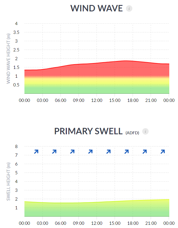
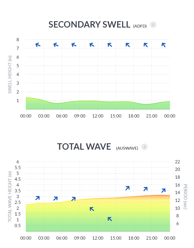
Fish Ranger provides a full wave and swell breakdown with Wind Wave, Primary Swell, Secondary Swell and Total Wave charts so you know how much chop there will be and how much rolling swell there will be and from what directions.
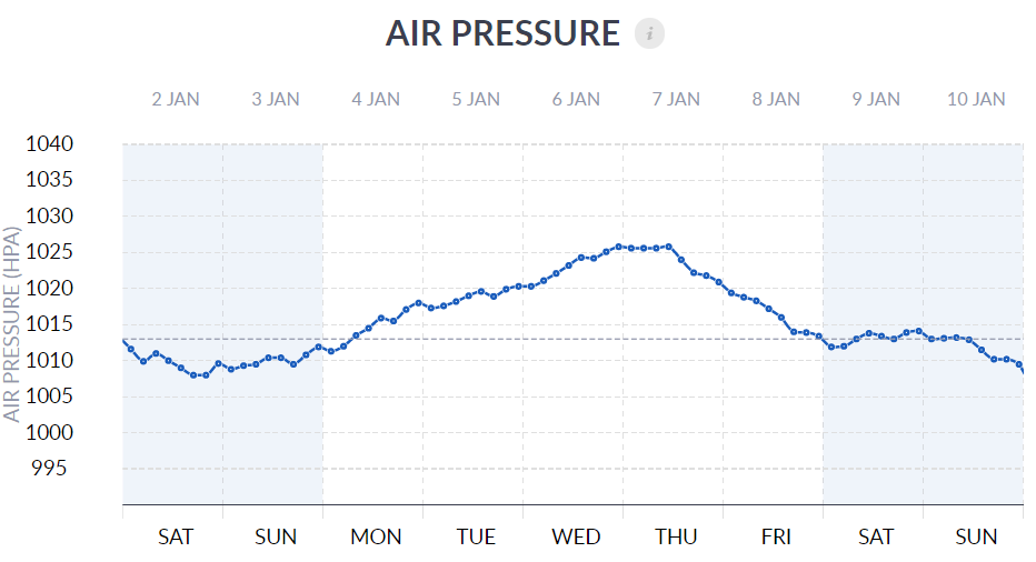
If you fish the barometer you also get 10 days of air pressure forecast.
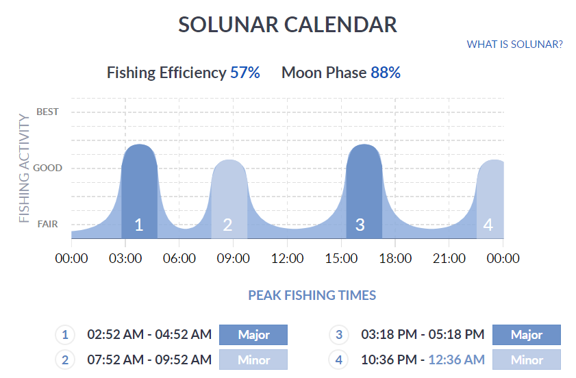
There’s also a Solunar Calendar so you can see the best bite times
Fish Ranger was built to be the best weather app for Australian fishermen. The weather forecast isn’t always going to be right but you want to get the best information before you head out and Fish Ranger will give you that. Like I said in its free version it will give you more than any other app out there so you don’t have to subscribe to get its benefits, but if you do you will get lots more value. I built it to be used, my vision is for all Australian Fishermen to know about and use the app. If you haven’t already give it a go and see.
If you have any questions about what I’ve written here, or want to see other apps included on this list, then send an email to support@fishranger.com.au
And if you want to understand more about weather models and weather systems then read our article here.
Joe